
Packrafting the Chetco River: Turning this Oregon classic into a shuttle-less loop.
- Tim Kelley
- Aug 21, 2020
- 4 min read

Updated: Dec 4, 2025
Why Chetco?:
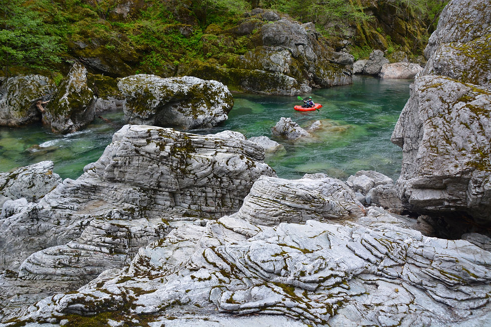
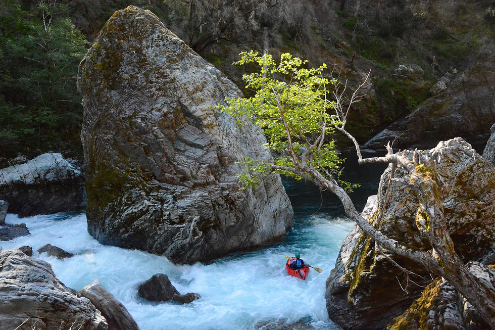
The Chetco flows out of Southwest Oregon’s Kalmiopsis Wilderness. While the Chetco’s beauty and whitewater are on par or superior to its more popular multi-day neighbors, the Rogue and Illinois, a long hike in keeps most paddlers away. Once on the river, you will be treated to iridescent turquoise waters, impressive canyons, and unspoiled wilderness camping.
Why Packraft?:
While packrafting has yet to achieve a following in the Northwest in the way it has in Alaska or the desert southwest, the Chetco seems poised to become the Northwest’s premier packrafting destination. Small crafts are pretty much the only option for paddling the Chetco. Even at higher flows, there are enough congested boulder gardens and tight slots that anything much larger than a kayak would be cumbersome. The hike to the river will likely dictate craft selection. In the summer, a four-mile option opens up, but better flows exist in the late winter and spring (when the summer road is closed), requiring a 10-mile hike. While hiking in a kayak is a fine option, I would personally choose to packraft this river at all but high flows. Due to the COVID-19 pandemic, we decided to research options for doing the Chetco in a different way that would eliminate the need for more human contacts by foregoing a long shuttle that would mean multiple vehicles and more gas stations, or hiring a shuttle driver. After some time scanning maps, we came up with a new loop route on the Chetco that involved a bike shuttle and an extended hike.
Chetco trailhead options:

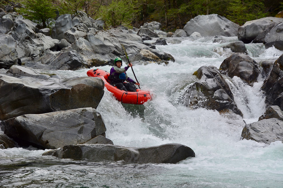
Water Levels: Packrafts can extend the runnable season of the Chetco. It is worth noting that the location of the Chetco gauge is near the mouth of the river in Brookings, far from the put-in. If the gauge is reading 1500cfs, which might sound like a lot for an intimate IV+ canyon run, you might actually have 500cfs at the Slide Creek put-in. While kayaks will want 1500 cfs at a minimum, inflatables can negotiate this run down to 500 cfs. We found a level of 1,000 cfs was enough water for most of the run but the canyon section below Slide Creek was a little boney for a few rapids. That said, this canyon is the hardest whitewater on the run, and higher flows would eliminate the recovery pools between rapids. Below this canyon, the Chetco gains lots of water from tributary streams, and once we passed Box Canyon Creek, the run cleaned up and channelized well.
Difficulty:
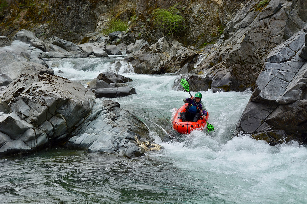
The Chetco earns a class IV-V rating from American Whitewater. While that rating might be warranted at high flows or because of the run's remote nature, most of the run is class III-IV with the section between Slide Creek and Tolman Bar offering a couple class IV+ drops and one class V. This is still an advanced run but at lower flows portaging is possible at river level and the run has a forgiving pool drop character.
As a loop: (By using the Johnson Butte/Vulcan Peak Trailhead and paddling the Chetco Gorge)
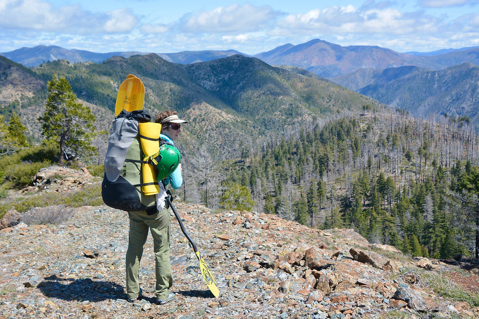
The Bike: When we first considered this route, we wondered why nobody had done the Chetco as a loop, given it appeared to be only 15 miles of forest roads separating the South Fork Campground take-out and our proposed trailhead. While you certainly wouldn’t consider this route with a kayak, with packrafts it seemed like only a little extra work for a lot less driving and no need for a shuttle driver or second vehicle. What turned out to be a lot of work was the bike shuttle. That 15-mile dirt road to the trailhead has a net gain of 5400 feet. While we were excited to pioneer this loop option, I now appreciate why this seemingly obvious solution hasn’t already become popular. If you want to repeat it just be prepared for a big uphill grind and bring a gravel road-ready bike that has more than the 12 gears my heavy mountain bike has. I did the ride in just over 2.5 hours but my legs were feeling lame for the rest of the hike to the river. We hid and locked the bike a few minutes off the trail and picked it up at the end of our trip. If you did have a party with two vehicles and you don't mind four extra miles of hiking, you could forego the bike shuttle and still DRAMATICALLY reduce your driving time and fuel costs by using this route.
The Hike: Only four miles longer than the Babyfoot Lake hike, the route is on good trail for most of the way as it descends about 2,000 feet to the river from the Vulcan Peak/Johnson Butte trailhead. Due to a recent burn, the descent trail from Johnson Butte to Box Canyon Creek is not in great shape, but we generally were able to find sections of the trail when we needed them.
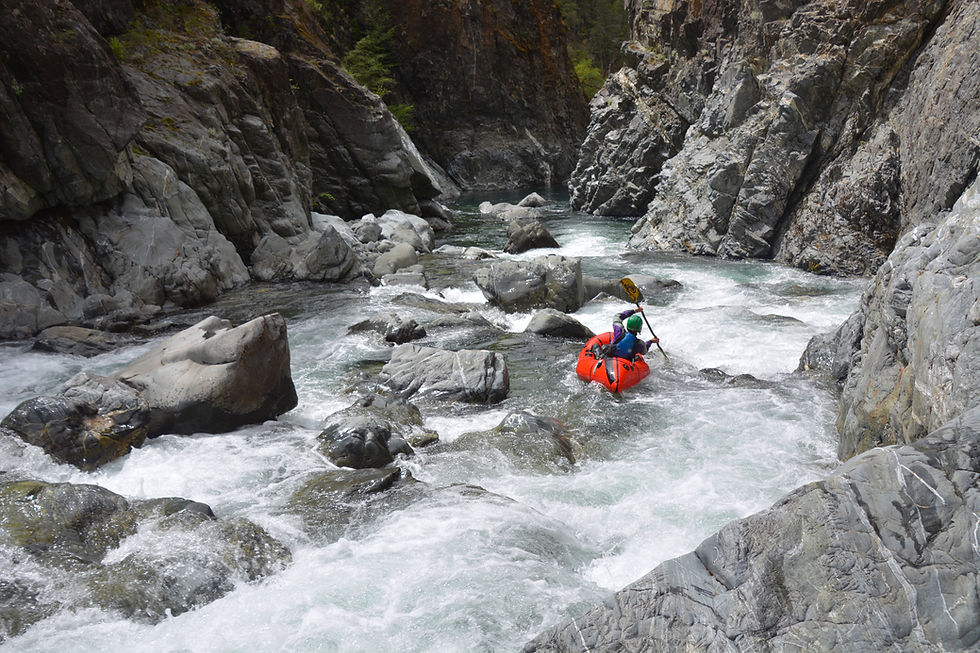
The Chetco Gorge: Paddling the Chetco Gorge is not typically included as part of the multiday trip, but it made logistical sense for us because it added paddling to our loop while shortening our bike shuttle. The gorge has two class V rapids. Both are challenging, and the first rapid, Candycane, has some serious sieve hazards. That being said, both rapids are easy to portage along the river right, and the rest of this section is mostly scenic class II floating.


Comments